.png)
Neighborhood Guide
We've divided the Baltimore area's residential communities into three regions: North of Baltimore (Baltimore County), Downtown Baltimore, and South of Baltimore (Howard County).
The data below, shared courtesy of the Johns Hopkins Medical Auxiliary (JHMA), shows where most Johns Hopkins residents, fellows, and new attending physicians lived during the 2022-2023 academic year.

Graph copyright of Lokhandwala Enterprises USA, LLC
Getting Started
To get a true feel for Baltimore area neighborhoods, we recommend spending an afternoon driving around, if you have the time. Neighborhoods north and south of the city provide a more suburban setting: single-family homes and townhomes with larger yards and green spaces. Coming from the north, it's a 25-minute drive to downtown Baltimore in normal traffic. The MTA LightRail operates routes from Hunt Valley (north of Lutherville-Timonium) to BWI and points downtown, including Camden Yards, but the line stops several blocks from Johns Hopkins Hospital. Traffic is heavier commuting from the south. The drive on I-95 from Columbia to downtown Baltimore takes roughly 30 minutes in ideal conditions.
In contrast, Baltimore's historic downtown neighborhoods offer a distinctive city-dwelling experience: more compact and close-knit living spaces with easy access to the best of Baltimore's restaurants, workplaces, nightlife, and attractions. Baltimore's public transit system isn't as widespread or reliable as those in Washington, D.C. or New York City. However, Baltimore's MetroSubWayLink runs from Owings Mills to directly underneath Johns Hopkins Hospital and is scheduled every eight to ten minutes during morning and evening rush hours. Parking can be tight in certain downtown neighborhoods. If you’re bringing a car, make sure you have a designated parking spot or parking pad.
For Johns Hopkins University employees and students, JHMI Transportation provides free Employee and Student Courtesy Shuttles connecting from the main campus to multiple points in the city, as well as to affiliate/satellite campuses. JH SafeRide (powered by Lyft) now offers free transportation for all Johns Hopkins pre-doctorate students in the School of Medicine, School of Nursing or School of Public Health living within designated boundaries. Johns Hopkins Corporate Security also provides 24/7 Walking Escort Services within campus limits. Ask your training program about similar transportation initiatives, and check out our blog for additional commute details.
The University of Maryland Medical Center provides employees and students with a free University of Maryland Shuttle service, along with UMB Safe Walk/Safe Ride and other public transportation options . For more information on the Shuttle, log into UMMC Insider Parking and Transportation.
Baltimore County and Howard County are home to several designated Blue-Ribbon Schools. For additional school data, we offer links to GreatSchools.org ratings in each neighborhood. For crime statistics, livability information, and other neighborhood data, we offer links to AreaVibes. We make no personal assessments/comments or guarantees about school quality, resident demographics, or crime statistics. Use the provided links to further your own research in these areas.
As you plan your move to Baltimore, we also recommend joining physician/family networking groups such as the Johns Hopkins Medical Auxiliary (JHMA). You'll make valuable connections in a new city - plus you'll get the "inside scoop" on local neighborhoods and member events.
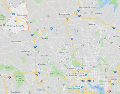
North of Baltimore
Sparks Glencoe
Baltimore County
Driving Distance to JHH: 23 miles (27 min)
Driving Distance to UMMC: ~23 miles (29 min)
Driving Distance to JHBV: ~26 miles (27 min)
AreaVibes Livability Score: 74
GreatSchools Link
Residents of the charming communities of Sparks Glencoe, located approximately 20 miles north of Baltimore, enjoy a serene lifestyle, with convenient access to the retail shops, supermarkets, and restaurants along York Road (Route 45). Sparks is home to the corporate headquarters of USA Lacrosse, Firaxis Games, Apex Tool Group, and FILA USA. Explore fine dining and history at the 283-year-old fieldstone house restaurant, The Milton Inn. Sparks Glencoe offers proximity to Gunpowder Falls and the North Central Railroad Hike and Bike Trail for those who appreciate an active lifestyle. Sparks Glencoe predominantly consists of single-family homes while also offering other housing options such as townhomes, condominiums, and apartments. Easy access to major highways like I-83 and I-695 facilitate a convenient commute to the Baltimore and Washington D.C. areas.

Phoenix
Baltimore County
Driving Distance to JHH: ~22 miles (32 min)
Driving Distance to UMMC: ~23 miles (34 min)
Driving Distance to JHBV: ~26 miles (32 min)
AreaVibes Livability Score: 74
GreatSchools Link
Phoenix boasts some of Baltimore County’s most expensive homes, particularly in the Big Gunpowder Falls area, surrounded by wooded land for privacy and tranquility. Residents and visitors enjoy exploring the “enchanted” woods of Gunpowder Falls Sweet Air Area, along with the dining options in the nearby Jacksonville neighborhood. Golf enthusiasts can enjoy the sweeping views of Baltimore County at the Eagle’s Nest Country Club. As with Sparks/Glencoe, commuters from Phoenix enjoy easy access to I-83 and I-695.

Phoenix
Hunt Valley / Cockeyville
Baltimore County
Driving Distance to JHH: ~19 miles (26 min)
Driving Distance to UMMC: ~19 miles (28 min)
Driving Distance to JHBV: ~22 miles (26 min)
AreaVibes Livability Score: 74
GreatSchools Link
An easy drive north from Baltimore City via I-83, the communities of Hunt Valley and Cockeysville offer a balance of peaceful residential areas amid a bustling commercial district. Housing options range from sprawling estates and luxury townhomes to higher-end single-family homes with spacious yards, as well as condominiums, and apartments. Hunt Valley is a prime location for traveling to neighboring areas, including Sparks and Timonium, with easy access to public transportation through the MTA Light Rail and buses.
The Hunt Valley/Cockeysville area hosts well-known businesses like McCormick & Co. and PHH Corporation. The Hunt Valley Towne Centre, featuring Regal Cinema Theatre and popular retail shops like Wegmans, Marshalls and Dick’s Sporting Goods, is a hub for shopping, with an array of casual and fine dining restaurants and national fast food chains. At the weekly Cockeysville Farmers Market, patrons support local farmers and artisans while indulging in fresh produce, artisanal crafts, and delectable treats. Car enthusiasts can join the Hunt Valley Horsepower events every Saturday for social gatherings. Outdoor adventurers enjoy Oregon Ridge Nature Center and NCR trails for hiking, biking, and exploration. For swimming, fishing and fun during the summer months, Beaver Dam Swim Club is a hot spot. Residents also go tubing at Gunpowder Falls. Hayfields Country Club offers golfing and year-round social memberships.

Lutherville-Timonium
Baltimore County
Driving Distance to JHH: ~15 miles (25 min)
Driving Distance to UMMC: ~16 miles (24 min)
Driving Distance to JHBV: ~15 miles (19 min)
AreaVibes Livability Score: 89
GreatSchools Link
For quintessential suburban living close to the city, you can't top Lutherville-Timonium (our home since 2015). The area offers a variety of attractive housing options, including luxury townhome communities with ample common green space, as well as 1, 2, and 3-bedroom condominiums and affordable single-family homes. With easy access to I-83, Lutherville-Timonium is only a 20-minute commute to downtown - if you beat the rush hour. The MTA LightRail also makes multiple stops in the area.
Lutherville-Timonium is home to a variety of shopping areas, restaurants, schools, and public parks – including Loch Raven Reservoir. The nearby Hunt Valley Towne Centre offers shopping, dining, and a summer outdoor concert series. The Maryland State Fair is held in Timonium every August/September.

Towson
Baltimore County
Driving Distance to JHH ~13 miles (21 min.)
Driving Distance to UMMC ~16 miles (23 min.)
Driving Distance to JHBV ~14 miles (19 min.)
AreaVibes Livability Score: 85
GreatSchools Link
Towson boasts the comforts of small, college-town living and the proximity to city amenities. A variety of affordable single-family homes and townhomes are located convenient to I-695 and an easy commute downtown. Home to Towson University and Goucher College. Towson is known for its restaurants and shops, including Towson Town Center - Baltimore County’s largest indoor mall with a Cinemark multiplex - and Towson Square open-air mall. Join the Y in Towson (Orokowa), featuring an indoor pool, family-friendly amenities, and discount rates for Johns Hopkins employees. Notable community activities in Towson include the annual Fourth of July Parade.
Also part of Towson and just seven miles from downtown, Loch Raven and Loch Raven Village offer suburban living just outside the city limits. These are two communities of attractive and affordable brick townhomes built in the 1950s. Many of the homes feature hardwood floors and basement recreation areas. Both neighborhoods are convenient to Towson's shopping and entertainment centers, as well as to schools and major highways, including I-695. Parking is sometimes tight here, but many homes have backyard parking pads for off-street convenience.

Rodgers Forge
Baltimore County
Driving Distance to JHH ~10 miles (22 min.)
Driving Distance to UMMC ~10 miles (20 min.)
Driving Distance to JHBV ~16 miles (24 min.)
AreaVibes Livability Score: 85
GreatSchools Link
This tree-lined neighborhood of charming brick townhomes is traditionally pricier than Towson and known for its public open spaces and active Rodgers Forge Community Association. Part of the greater Towson area, Rodgers Forge offers easy access to Towson’s shopping and entertainment centers in a picturesque suburban setting just miles from downtown. The Rodgers Forge Historic District is on the National Register of Historic Places and home to beautiful parks, including its “Tot Lot” playground.

Rodgers Forge
Parkville
Baltimore County
Driving Distance to JHH ~11 miles (20 min.)
Driving Distance to UMMC ~17 miles (21 min.)
Driving Distance to JHBV ~10 miles (14 min.)
AreaVibes Livability Score: 77
GreatSchools Link
Just outside of Towson limits, Parkville is another suburb with a “hometown” feel. Parkville does not have as many open spaces or nearby entertainment as neighboring towns; however, Zumba at Putty Hill Park offers local skating and recreational opportunities. Plus, the amenities of Towson and White Marsh are minutes away by car.

Pikesville
Baltimore County
Driving Distance to JHH ~14 miles (22 min.)
Driving Distance to UMMC ~16 miles (20 min.)
Driving Distance to JHBV ~22 miles (25 min.)
AreaVibes Livability Score: 68
GreatSchools Link
Pikesville, the closest northwestern suburb to Baltimore, is an easy commute downtown from I-695. With a population of only 30,000 people, it’s another option for those city commuters searching for a small-town feel. Reiserstown Road provides a hub of restaurants and amenities – although traffic can become heavy in that area.

Owings Mills
Baltimore County
Driving Distance to JHH ~21 miles (27 min.)
Driving Distance to UMMC ~19 miles (21 min.)
Driving Distance to JHBV ~27 miles (28 min.)
AreaVibes Livability Score: 78
GreatSchools Link
Owings Mills has become less popular in recent years. Nevertheless, residents still enjoy numerous townhomes and condominiums with easy access to the Northern end of the Baltimore Metro line, for an easy commute downtown with a stop inside Johns Hopkins Hospital. Owings Mills is home to satellite branches of the Community College of Baltimore, ITT technical Institute, and Stevenson University – as well as the Irvine Nature Center and Baltimore Ravens Headquarters. Residents also enjoy the newly-constructed Foundry Row shopping center with restaurants, retail stores, and Wegman’s grocery store.
Middle River / White Marsh / Nottingham
Baltimore County
Driving Distance to JHH ~11 miles (18 min.)
Driving Distance to UMMC ~15 miles (21 min.)
Driving Distance to JHBV ~8 miles (15 min.)
Area Vibes Livability Score: 81
GreatSchools Link
The growing communities of White Marsh, Nottingham, and Middle River are known for secluded and affordable single-family homes with easy access to I-95, I-695, and numerous businesses and amenities. New residential developments, such as Whitemarsh Estates, offer popular suburban housing options.
The Avenue at White Marsh is a well-known hub for shopping and dining that also sponsors seasonal community events such as summer musical performances, outdoor ice skating, and a tree lighting and holiday parade. The White Marsh Mall is another local shopping destination, with special activities planned weekly for visitors of all ages and interests. Ikea and Target are within a few miles’ drive, and residents frequent The Y in Perry Hall for recreation and childcare.

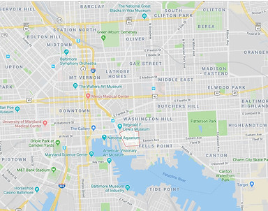
Downtown Baltimore
Mount Washington
Baltimore City/County
Driving Distance to JHH ~8 miles (16 min.)
Driving Distance to UMMC ~8 miles (14 min.)
Driving Distance to JHBV ~11 miles (23 min.)
AreaVibes Livability Score: 72
Great Schools Link
Mount Washington is a thriving historic community of affordable single-family homes and townhomes with spacious yard. This neighborhood features suburban-style living within city limits. Mount Washington Village and Mount Washington Mill are home to numerous restaurants, salons, and stores, including Whole Foods and Starbucks. The Baltimore Light Rail’s Camden Station, located nearby, provides a quick commute to downtown and BWI. Mount Washington has plenty of tree-filled streets and open spaces, including University of Baltimore Fields, and other beautiful sights, such as the Clyburn Arboretum. The Johns Hopkins Conference Center, Mount Washington Pediatric Hospital, and Sinai Hospital are all located in Mount Washington.

Homeland / Belvedere Square
Baltimore City/County
Driving Distance to JHH ~8 miles (18 min.)
Driving Distance to UMMC ~9 miles (17 min.)
Driving Distance to JHBV ~9 miles (24 min.)
AreaVibes Livability Score: 73
GreatSchools Link
The Homeland/Belvedere Square area, bordered by Charles Street and York Road near the Towson line, is a neighborhood of mostly older, affordable single-family homes with spacious yards. Residents live close to entertainment at the historic Senator Theater, as well as events sponsored by Loyola University. The Belvedere Square Market offers many restaurants and an outdoor Summer Sounds Concert Series on Friday nights.

Roland Park
Baltimore City/County
Driving Distance to JHH ~7 miles (17 min.)
Driving Distance to UMMC ~8 miles (16 min.)
Driving Distance to JHBV ~10 miles (25 min.)
AreaVibes Livability Score: 81
GreatSchools Link
Bordered by Falls Road and the East Northern Parkway, Roland Park was America’s first planned suburban community. Roland Park has a “college-town feel,” offering a variety of reasonably-priced (compared to city rates) single-family homes close to restaurants, multiple private schools, and St. Mary’s Seminary & University. For approximately the same cost as a downtown apartment or townhome, Roland Park residents enjoy ample parking on tree-lined streets, plus access to the beautiful Roland Park Pool. Roland Park Historic District is on the National Register of Historic Places.

Hampden / Druid Hill Park
Baltimore City
Driving Distance to JHH ~4 miles (12 min.)
Driving Distance to UMMC ~5 miles (11 min.)
Driving Distance to JHBV ~7 miles (19 min.)
Area Vibes Livability Score: 71
GreatSchools Link
Located along the Woodbury light rail stop, Hampden offers a variety of housing options, from townhomes with backyards to apartment living. Hampden boasts many restaurants, bars, and shops. A shuttle runs from the nearby Johns Hopkins Homewood Campus to the Johns Hopkins Hospital downtown. Hampden residents enjoy shopping and dining on 36th Street, known as “The Avenue,” as well as checking out the street art.
Each summer, Hampden celebrates HONfest – (honoring the Baltimore term of endearment: “hon” or “honey”) a music and arts festival where 35,000+ attendees sport beehive hairdos, cat’s-eye glasses, poodle skirts, and flamingo attire. Other annual Hamden events include September’s Hampdenfest, celebrating local merchants.
The area’s historic Druid Hill Park, a hub for picnics and other recreational activities, is currently undergoing renovations. The City plans to decrease the size of the Druid Lake Reservoir to make room for an additional 14 acres of green space, which a wider promenade, a cycling path, and an amphitheater. Adjacent to Druid Hill Park is the Maryland Zoo, a must-see attraction for visitors.

Charles Village
Baltimore City
Driving Distance to JHH ~3 miles (12 min.)
Driving Distance to UMMC ~3 miles (10 min.)
Driving Distance to JHBV ~7 miles (20 min.)
AreaVibes Livability Score: 73
GreatSchools Link
Charles Village is a community of spacious rowhomes located adjacent to Johns Hopkins University campus and less than three miles from Johns Hopkins Hospital. Rent in Charles Village is typically more affordable than other downtown neighborhoods, such as Fells Point or Canton, and the homes offer plenty of yard space. Charles Village is close to plenty of restaurants, a year-round farmer’s market, and grocery stores such as Eddie’s of Roland Park, as well as the Enoch Pratt Library, Baltimore Museum of Art, and Hampden’s 36th Street.

Mount Vernon
Baltimore City
Driving Distance to JHH ~2 miles (8 min.)
Driving Distance to UMMC ~2 miles (8 min.)
Driving Distance to JHBV ~4 miles (15 min.)
AreaVibes Livability Score: 69
GreatSchools Link
Mount Vernon offers center-city living at its best, with a mix of modern high-rise apartment buildings and older townhomes surrounded by a beautiful park and the nation’s first monument dedicated to George Washington. Residents enjoy easy access to restaurants, museums, and theaters, as well as the annual FlowerMart celebration each May, outdoor concerts and festivals throughout the year, and the Monument Lighting each December.

Butchers Hill
Baltimore City
Driving Distance to JHH ~0.5 miles (4 min.)
Driving Distance to UMMC ~3 miles (11 min.)
Driving Distance to JHBV ~3 miles (10 min.)
AreaVibes Livability Score:
GreatSchools Link
Located Northeast of Patterson Park, Butchers Hill is close enough to the city’s main historic neighborhoods, yet tucked away enough to provide a quiet and friendly hometown atmosphere. As with many of Baltimore’s historic areas, rent in Butchers Hill can be high. However, residents enjoy the ease of living close to The Johns Hopkins Medical Center, along with the activities of Patterson Park. The Butchers Hill Association hosts multiple neighborhood activities, including a house tour, flea markets, and neighborhood cleanups.

Patterson Park
Baltimore City
Driving Distance to JHH ~1.5 miles (7 min.)
Driving Distance to UMMC ~3 miles (12 min.)
Driving Distance to JHBV ~2 miles (9 min.)
AreaVibes Livability Score: 71
GreatSchools Link
Patterson Park is a popular pet-friendly neighborhood consisting mostly of newly-rehabbed rowhomes and apartments situated between Canton and Fells Point. Listed on the National Register of Historic Places, Patterson Park is home to 155 acres of picturesque acres of green space with a dog park and recreational facilities. The Patterson Park Summer Concert Series attracts crowds from throughout the city, and the unique Patterson Park Pagoda is a widely-recognized landmark and gathering point.

Canton
Baltimore City
Driving Distance to JHH ~1.5 miles (8 min.)
Driving Distance to UMMC ~3 miles (13 min.)
Driving Distance to JHBV ~2 miles (10 min.)
AreaVibes Livability Score: 77
GreatSchools Link
A great place for newly-minted Baltimoreans looking to make friends, Canton is a popular upscale waterfront area known for its sturdy brick townhomes and neighborly atmosphere. Canton residents enjoy a peaceful and pet-friendly community with easy access to Patterson Park, Highlandtown, Greektown, and the nightlife of Fells Point and Downtown.
Although tree-lined streets are not as plentiful in Canton, this neighborhood is home to Fishing Pier Park and Canton Waterfront Park, which offers first Thursday concerts. The picturesque Waterfront Promenade connects Canton to Fells Point. Canton Square is another lively spot with multiple pubs, shops, and restaurants – as well as festivals and post-sporting celebrations. During warmer months, the Canton Waterfront Farmers’ Market provides fresh food and camaraderie in the fresh air.
Street parking can be sparse in Canton. However, the neighborhood’s Safeway and Harris-Teeter offer grocery pickup, adding to the reasons why many residents leave their cars at home. The new Canton Crossing shopping center boasts several grocery stores, clothing stores, and a Target.

Upper Fells Point
Baltimore City
Driving Distance to JHH ~1.3 miles (8 min.)
Driving Distance to UMMC ~2 miles (9 min.)
Driving Distance to JHBV ~3 miles (12 min.)
AreaVibes Livability Score: 77
GreatSchools Link
Upper Fells Point is a subdivision comprised mostly of historic row homes bordering Patterson Park. Residents here can enjoy the best of multiple downtown neighborhoods, along with the pet-friendly amenities and recreational opportunities of Patterson Park. The Upper Fells Point area is situated between Canton and Butchers Hill, and just a short drive away from Whole Foods and the adjoining Harbor East neighborhood.

Fells Point
Baltimore City
Driving Distance to JHH ~1.3 miles (8 min.)
Driving Distance to UMMC ~2 miles (9 min.)
Driving Distance to JHBV ~3 miles (14 min.)
AreaVibes Livability Score: 77
GreatSchools Link
Situated near Inner Harbor, Fells Point offers upscale urban housing in one of Baltimore’s most picturesque settings. Fells Point residents live among some of Baltimore’s best retail shops, restaurants, and pubs. Broadway Market, a year-round indoor market built in 1786, is a main attraction in Fells Point.
Fells Point is a bustling hub of activity, especially on weekend nights. Traffic can be heavy and street parking can be limited in Fells Point. However, easy access to Uber/Lyft and the Johns Hopkins Shuttle are easy remedies. Plus, residents can easily connect to Harbor East, Tide Point, Federal Hill, and other locations via Water Taxi. The television show “Homicide: Life on the Streets” was filmed in the old city pier along the Fells Point waterfront, and that area has now become The Sagamore Pendry Hotel.

Harbor East / Harbor Point
Baltimore City
Driving Distance to JHH ~1.5 miles (8 min.)
Driving Distance to UMMC ~1.5 miles (8 min.)
Driving Distance to JHBV ~1.5 miles (8 min.)
AreaVibes Livability Score: 72
GreatSchools Link
The newly-developed and growing neighborhood of Harbor East offers both luxury and convenience for city dwellers with busy schedules. Comprised mostly of upscale high-rise apartments, Harbor East is situated within a few blocks of a Whole Foods, retail stores, restaurants, and a Landmark Movie Theater (boasting in-movie bar service). With easy access to the Water Taxi, Charm City Circulator, and Uber/Lyft, Harbor East residents rarely drive for groceries, coffee, recreation, or a night out.
The nearby pet-friendly neighborhood of Harbor Point provides the bustle of Fells Point and the modern conveniences of Harbor East. Plus, residents experience a beautiful view of the waterfront on nearly every corner.

Ridgely's Delight
Baltimore City
Driving Distance to JHH ~2.5 mile (12 min.)
Driving Distance to UMMC ~0.5 miles (4 min.)
Driving Distance to JHBV ~7.7 miles (15 min.)
AreaVibes Livability Score: 83
GreatSchools Link
Ridgely’s Delight is another historic neighborhood located just west of downtown. Known for its rowhomes, many of which date back to the 19th century, you will see homes with brick facades, bay windows, and other original details, as well as newer condominiums and apartments. Home of the Baltimore Orioles, Camden Yards is nearby. Ridgely’s Delight is also home to several historic sites, including the Edgar Allan Poe House & Museum, and numerous parks, including Carroll Park and Federal Hill Park.

Ridgely's Delight
Little Italy
Baltimore City
Driving Distance to JHH ~1 mile (6 min.)
Driving Distance to UMMC ~1.5 miles (7 min.)
Driving Distance to JHBV ~3 miles (15 min.)
AreaVibes Livability Score: 73
GreatSchools Link
Little Italy, situated between Inner Harbor and Fells Point, is a mix of old and new homes, restaurants, and retail shops – including 20 of the city’s best Italian eating establishments. Residents can live in historic older row homes and apartments or the newer townhomes built as part of the Albemarle Square development.
Locust Point / Federal Hill
Baltimore City
Driving Distance to JHH ~6 miles (17 min.)
Driving Distance to UMMC ~4 miles (9 min.)
Driving Distance to JHBV ~6 miles (13 min.)
AreaVibes Livability Score: 79
GreatSchools Link
Locust Point, at the southern end of South Baltimore Peninsula, is rich in history and a unique neighborhood to explore. Locust Point features rarely found three-window-wide rowhomes and double-wide rowhomes. Alongside these historic row houses are newly-built high-rises of luxury apartments and condominiums, high-tech offices and new businesses, showcasing ongoing restoration and modernization efforts. Conveniently situated, Locust Point is a short drive away from Riverside, Federal Hill, Inner Harbor, M&T Bank Stadium, and Camden Yards. The neighborhood benefits from water taxis, rideshares and public transportation, facilitating easy access to various parts of Baltimore City.
Best known as home to Fort McHenry Park, the birthplace of our National Anthem (“The Star-Spangled Banner”), the area’s tight-knit residents engage in numerous beautification projects, including multiple community gardens and neighborhood events such as the Annual Locust Point Festival. Locust Point is quieter than other downtown neighborhoods like Fells Point, where nightlife is more vibrant. Nevertheless, visitors and residents can choose from plenty of restaurants, bars and social happenings. Residents can also enjoy recreational sports such as baseball, football and tennis at Latrobe Park and soak in the scenic city view along Inner Harbor. Tide Point, formerly the headquarters of Procter and Gamble Soap Company, now houses the Under Armour Global Headquarters.
Federal Hill, much like Fells Point, is a bustling upscale community of historic brick townhomes and single-family homes, known for its stunning views of Inner Harbor, green spaces, and a wide range of locally-owned shops, restaurants, and art galleries. Residents enjoy easy access to the historic Cross Street Market and its $7.3 million renovation project. The American Visionary Art Museum, a fixture of Federal Hill, hosts an annual Kinetic Sculpture Race, where participants maneuver self-made artwork through the city. Sitting atop Federal Hill are replicas of the famous cannons used in the War of 1812 to protect Baltimore against the British invasion.

Highlandtown
Baltimore City
Driving Distance to JHH ~2 miles (9 min.)
Driving Distance to UMMC ~4 miles (16 min.)
Driving Distance to JHBV ~1.4 miles (7 min.)
AreaVibes Livability Score: 76
GreatSchools Link
Located east of Patterson Park, Highlandtown is an arts-centric community with a main street that continues to grow and thrive. Highlandtown is home to historic older rowhomes offering spacious rooms and pet-friendly yards, often at rates more affordable than other downtown neighborhoods such as Canton and Fells Point. Residents enjoy ample parking and the neighborhood’s proximity to multiple art galleries and restaurants.

South of Baltimore
Catonsville
Baltimore County
Driving Distance to JHH: ~11 miles (22 min)
Driving Distance to UMMC: ~10 miles (16 min)
Driving Distance to JHBV: ~15 miles (20 min)
AreaVibes Livability Score: 79
GreatSchools Link
Situated west of Baltimore, Catonsville provides residents with a densely suburban atmosphere full of diverse housing options in neighborhoods of all sizes. Catonsville homes are typically more affordable than those in neighboring Howard County and boast convenient access to major highways like I-695 and I-70. When heading to downtown Catonsville, planning ahead is advisable due to limited parking availability. Commuters to Baltimore note occasional mass transit delays. Nevertheless, Catonsville’s proximity to Baltimore, Columbia, and Washington D.C expands residents’ access to job opportunities and amenities.
Catonsville is known as “Music City” due to the many music schools, stores, and performance sites within its limits. In the 1970s, Catonsville experienced rapid home construction, accompanied by the opening of a new business district along the newly-built Baltimore National Pike. Driving along Route 40 (Baltimore National Pike), you will find numerous restaurants, supermarkets, retail shops and popular franchises. Catonsville proudly hosts the University of Maryland, Baltimore County (UMBC) and campuses of the Community College of Baltimore County (CCBC). Locals and tourists visit the town for attractions like the Benjamin Banneker Historical Park & Museum and Spring Grove Alumni Museum. Notable annual events include The Music City Maryland Festival and Catonsville Fall Festival. For outdoor enthusiasts, Catonsville is a haven, featuring attractions such as the Recycled Tire Playground in Patapsco Valley State Park.

Arbutus
Baltimore County
Driving Distance to JHH ~10 miles (22 min.)
Driving Distance to UMMC ~7 miles (10 min.)
Driving Distance to JHBV ~13 miles (20 min.)
AreaVibes Livability Score: 77
GreatSchools Link
Located southwest of Baltimore and close to I-95, Arbutus is neighborhood with a “college-town” feel, comprised mainly of single-family homes. The nearby University of Maryland Baltimore County campus is a popular spot for sporting events and other entertainment, and the town is home to a RC Hollywood Cinema 4 movie theater. The annual July 4th Boxcar Derby race is a key community event.

Glen Burnie
Anne Arundel County
Driving Distance to JHH ~13 miles (28 min.)
Driving Distance to UMMC ~11 miles (19 min.)
Driving Distance to JHBV ~13 miles (22 min.)
AreaVibes Livability Score: 72
GreatSchools Link
The quiet suburban neighborhoods of Glen Burnie, in Anne Arundel County offer affordable, easy living in a diverse setting of mostly single-family homes. The communities of Margate and Marley have a high concentration of colonial homes, while row houses can be found closer to the city. The subdivision of Tanyard Springs is experiencing rapid development, with new townhomes and businesses emerging.
Glen Burnie boasts convenient commuting to Baltimore, Annapolis, and Washington D.C., thanks to proximity to major highways like I-695, I-97, Route 100, and Ritchie Highway (Route 2). While having a vehicle is recommended, residents also have access to MARC Train, Baltimore Light Rail, Bus Rapid Transit, and local bus services. Baltimore Washington International Thurgood Marshall Airport (BWI) is just 10 miles west. Glen Burnie residents and visitors enjoy various nearby dining, shopping, and entertainment options, including Marley Station Mall and Arundel Mills Mall. Grocery shopping is convenient, with large retailers like Costco Wholesale, Target and Wal-Mart nearby. Nature lovers can explore Patapsco Valley State Park and Glen Burnie Park, while those seeking outdoor excitement can visit Pasadena Paintball Park.

Hanover
Anne Arundel County
Driving Distance to JHH ~13 miles (25 min.)
Driving Distance to UMMC ~11 miles (18 min.)
Driving Distance to JHBV ~14 miles (22 min.)
AreaVibes Livability Score: 70
GreatSchools Link
Hanover, a suburban community situated between Baltimore and Washington, D.C., has experienced significant residential and commercial growth in recent years. The housing market in Hanover is competitive, with primarily single-family homes. Condominiums and apartments are also available. Hanover offers convenient access to major highways like I-95, MD Route 295, and MD Route 100, making it a popular location for commuters. Additionally, the nearby BWI Thurgood Marshall Airport, Fort Meade and the National Security Agency contribute to the area's accessibility and economic growth. Hanover is home to Anne Arundel Community College and healthcare facilities such as the Anne Arundel Medical Center and the University of Maryland Baltimore Washington Medical Center (UM BWMC), an acute-care facility. Local shopping and entertainment venues include the Maryland Live! Casino and the Arundel Mills shopping mall, which is one of the largest malls in the state.

Ellicott City
Baltimore County
Driving Distance to JHH ~14 miles (30 min.)
Driving Distance to UMMC ~19 miles (21 min.)
Driving Distance to JHBV ~24 miles (29 min.)
AreaVibes Livability Score: 76
GreatSchools Link
Ellicott City is a historic town that offers picturesque views of the Patapsco Valley - ideal for suburban living, but within reasonable commuting distance to both Baltimore and Washington, D.C. Downtown Ellicott City boasts unique shops, residences, and fine dining. Escape from the city feel of Baltimore. Cost of living in Ellicott City (and Howard County in general) is higher compared to the neighborhoods North of Baltimore. However, communities such as Shipley’s Grant are known for spacious homes and pet-friendly yards within minutes of major retailers, parks, and trails.

Columbia
Howard County
Driving Distance to JHH ~23 miles (32 min.)
Driving Distance to UMMC ~12 miles (19 min.)
Driving Distance to JHBV ~17 miles (29 min.)
AreaVibes Livability Score: 79
GreatSchools Link
Columbia is a growing community of single-family homes, townhomes, and condominiums attracting those who commute to both Baltimore and Washington, D.C. Its three lakes (Lake Kittamagundi, Lake Elkhorn, and Wild Lake) offer numerous outdoor activities. Columbia is also home to Howard County Community College, Loyola University Maryland, University of Maryland, Baltimore County, and Johns Hopkins University facilities, among other institutes of higher education. The Merriweather Post Pavilion is Columbia’s premier outdoor concert venue, and The Mall in Columbia is a popular shopping and entertainment center. Residents can access the Washington Metro System via the MTA commuter bus.

Annapolis
Anne Arundel County
Driving Distance to JHH ~32 miles (44 min.)
Driving Distance to UMMC ~30 miles (36 min.)
Driving Distance to JHBV ~32 miles (37 min.)
AreaVibes Livability Score: 78
GreatSchools Link
The capital city of Maryland, Annapolis, is a beautiful place to live. Nestled in Anne Arundel County, residents and visitors enjoy picturesque views of the Chesapeake Bay and Severn River. The city of Annapolis can have a higher cost of living. Housing such as single-family homes, townhomes, condos and apartments are more expensive compared to other parts of Maryland. Downtown Annapolis features smaller, older historic row houses and Eastport offers a variety of smaller, single-family homes. South River and South Annapolis showcase waterfront properties and larger homes with land while Broadneck Peninsula, considered the suburbs of Annapolis, provide housing options in quieter neighborhoods for those seeking more privacy.
The city of Annapolis is rich in maritime history, boasting numerous historic sites for exploration. Commuting is convenient with easy access to I-97, Route 50 and Route 2; however, the city’s popularity as a tourist destination brings traffic congestion. Annapolis Transit Bus System and water taxi services are also transportation options in the city.
Annapolis is home to the United States Naval Academy. The annual U.S Navy Blue Angels Show and the Military Bowl at the Navy-Marine Corps Memorial Stadium are crowd-drawing attractions. Also located in the heart of Annapolis is St. John’s College, the third oldest college in the United States, established in 1696.
Recognized as the Sailing Capital of the World, Annapolis hosts water sports events like the Annapolis Boat Shows and Spring Sailboat Show. Downtown Annapolis is a vibrant hub with its abundance of events and amenities. Annapolis Mall and Annapolis Harbor Center are home to an excellent selection of eateries and shops. Wholefoods, Target and a movie theater can be found at Annapolis Town Center, featuring condos for rent above the stores and restaurants. Explore the City Docks or enjoy the unique historic architecture on Main Street. Electric cart tours with Annapolis Event Tours provide a unique way to navigate, considering limited parking. Numerous parks cater to the outdoor adventurist, offering activities like jogging along the B&A Trail, kayaking and fishing at Quiet Waters Park or swimming at the pool in Truxtun Park. Sandy Point State Park offers stunning Bay Bridge views, a mile-long public beach, and events such as the Polar Bear Plunge and Lights on the Bay.

Rockville
Montgomery County
Driving Distance to JHH ~41 miles (56 min.)
Driving Distance to UMMC ~40 miles (49 min.)
Driving Distance to JHBV ~41 miles (56 min.)
AreaVibes Livability Score: 82
GreatSchools Link
Rockville, the largest city in Montgomery County, Maryland, boasts a rich history as one of the state’s oldest communities. Recognized as the “Best Place to Live in Maryland'' by Money Magazine in 2018, Rockville offers a vibrant and culturally diverse environment. Housing in Rockville is relatively pricier compared to many Maryland areas, however, the city offers services such as leaf clean-ups, camps and childcare, and much more. A diverse range of single-family homes, townhomes, condominiums and apartments can be found in Rockville. Rockville Historic District is also committed to preserving Rockville’s historical homes, buildings and areas.
Centrally located with convenient access to I-270, I-495 (Capital Beltway), and the Intercounty Connector (MD 200), commuting is easy to Gaithersburg, Baltimore, Washington D.C., and Northern Virginia. To lighten the daily commute, residents of Rockville have access to the Washington Metro Red Line and Brunswick Line at Rockville Metro Station and Twinbrook Station, along with Amtrak and MARC trains. Ride On buses also provide travel options within the city and county.
Rockville serves as a hub for software and biotech companies, including Cloudbolt and American Gene Technologies. Proximity to medical facilities like Shady Grove Hospital, Holy Cross Germantown, and Suburban Hospital adds to the city’s appeal. Rockville also hosts institutions such as the University of Maryland Global Campus, Johns Hopkins University Montgomery County Campus, Universities of Shady Grove, and Montgomery College. Rockville Town Square has a variety of restaurants, shops, a library, and a movie theater. Spending time outdoors is easy with over thirty parks in Rockville and various community events such as the Lunar New Year Celebration, races, marathons, sports events and festivals. Residents and visitors can encounter wildlife at Croydon Creek Nature Center, or explore the hiking trails, kayaking and boating at Lake Needwood. Cabin John Regional Park, boasting 530 acres, has an ice skating rink and a miniature ride-on-train.

Bethesda / Chevy Chase
Montgomery County
Driving Distance to JHH ~40 miles (55 min.)
Driving Distance to UMMC ~38 miles (47 min.)
Driving Distance to JHBV ~42 miles (50 min.)
AreaVibes Livability Score: 78
GreatSchools Link
Bethesda, located in Montgomery County, is a unique place to live for those seeking a blend of suburban charm and urban amenities. Bethesda neighborhoods are known for their diversity in architectural styles, ranging from historic homes dating back to the 1700s to modern spacious condos. Bethesda also offers a variety of housing options, including single-family homes, townhouses, and apartments. However, the housing market in Bethesda can be competitive, with prices reflecting the area’s desirability and amenities.
Conveniently located in proximity to Washington D.C, Georgetown and Silver Spring, commuting is made easy with access to major highways such as I-495, MD Route 355 and MD Route 187. Public transportation options, including the Washington Metro in downtown Bethesda, Montgomery County Ride On buses, and the Bethesda Circulator, assist in easing traffic congestion.
Bethesda is home to headquarters of many large corporations, including Marriott International, Lockheed Martin Corporation and Coventry Health Care. Additionally, Bethesda is host to the Walter Reed National Military Medical Center, one of the largest and most prominent military medical centers in the nation, National Institute of Health (NIH) and the Uniformed Services University of the Health and Sciences. Residents of Bethesda enjoy an abundance of entertainment options, with Bethesda Row standing out as a premier destination for dining, shopping, culture, and art. Additionally, the area offers luxury apartments located conveniently above the retail shops, providing easy access to urban necessities. For outdoor enthusiasts, the Capital Crescent Trail and Cabin John Regional Park offer opportunities for hiking and various recreational activities.
Chevy Chase, located in Montgomery County, is an affluent residential suburb of Washington D.C. known for its picturesque neighborhoods and tree-lined streets, with a mix of historic homes and modern developments. Three highways, MD Route 185, MD Route 410 and MD Route 191, border the town of Chevy Chase. Friendship Heights is a bustling nearby shopping district. Connecticut Avenue offers residents a wide selection of restaurants, bars and retail shops as well. Chevy Chase is also home to exclusive private clubs like the Chevy Chase Club and Columbia Country Club and host to the National 4-H Conference Center.

Bethesda
Silver Spring
Montgomery County
Driving Distance to JHH ~36 miles (49 min.)
Driving Distance to UMMC ~34 miles (42 min.)
Driving Distance to JHBV ~38 miles (46 min.)
AreaVibes Livability Score: 81
GreatSchools Link
Silver Spring, in Montgomery County, offers a vibrant atmosphere for spacious, suburban living close to Washington D.C. Silver Spring includes a broad spectrum of home choices. Notable properties include Cape Cod and Colonial-style estates located in the older, established area of Woodside Park. The southern neighborhood of Blair offers small bungalows. Single-family homes, townhouses, condos, and newly constructed apartment buildings are all available in Silver Spring, reflecting the area's rapid development to meet housing demand.
The Paul Sarbanes Transit Center in downtown Silver Springs serves approximately 60,000 passengers daily, with those utilizing the MARC Trains, Washington Metro, Metrobus, Ride On, buses, and taxi services. Major roads in Silver Spring include the Capital Beltway (I-495), MD 97, US 29, and MD 650. Commuters also have convenient access to the Intercounty Connector (ICC -MD 200).
Silver Spring is host to the U.S Food and Drug Administration, National Weather Service and the American Nurses Association. Residents also have access to many health facilities including the Holy Cross Hospital and its health centers. Silver Spring is also a haven for art connoisseurs. Known for its lively, diverse culture and art scene, it is home to the AFI Silver Theatre and Cultural Center, which showcases independent films, documentaries, and classic cinema. Additionally, Silver Spring hosts the annual Silverdocs Documentary Film Festival. Museums, art galleries and beautiful murals can be found throughout the city, with notable attractions such as the Blair Mural Festival Downtown and Public Art Walk. Silver Spring is renowned for its diverse culinary scene, featuring unique local eateries and popular chain restaurants. Downtown Silver Spring is also a hub for shopping and entertainment. The great outdoors of Silver Spring boast four major creeks, all surrounded by parks, including Wheaton Regional Park, with trails for hiking, picnic areas, and playgrounds for visitors to enjoy.

Silver Spring
Maps powered by Google Maps